James P. Rowley
Geospatial Data Scientist & Economics Researcher
Bridging the gap between complex spatial analysis, environmental monitoring, and economic modeling. Specializing in Python, Earth observation data, and automated infrastructure.
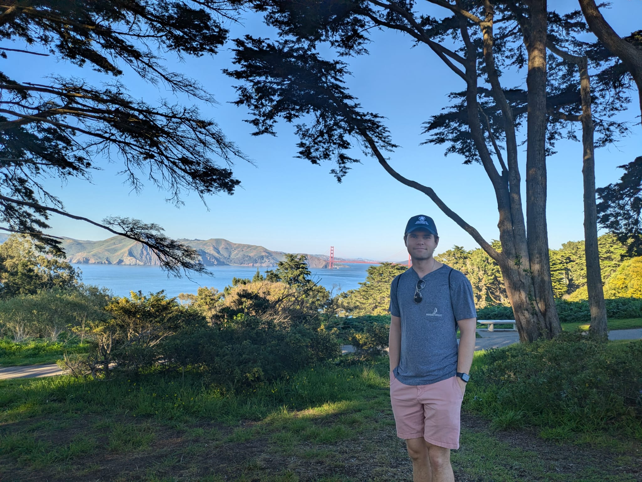
Geospatial Data Scientist & Economics Researcher
Bridging the gap between complex spatial analysis, environmental monitoring, and economic modeling. Specializing in Python, Earth observation data, and automated infrastructure.
I am a new grad with double-majors in Economics and Geography in the Schreyer Honors College at The Pennsylvania State University. My academic and professional work is centered around extracting actionable intelligence from massive datasets, whether mapping the cryosphere or analyzing market economics.
As a researcher at the Cryosphere Lab, I focused on the intersection of climate events and glacial geomorphology, utilizing tools like xarray, geopandas, and deep learning architectures to process terabytes of satellite imagery and climate reanalysis data.
Beyond academia, I have a strong foundation in systems administration. I deploy and manage local LLMs, Docker architectures, and secure networking environments (Linux/Tailscale; what this website is running on!) to ensure computational workflows are efficient, reproducible, and scalable.
Languages & Libraries: Python (xarray, rasterio, pandas, NumPy, TensorFlow)
Geospatial: QGIS, Esri Suite, Sentinel/Landsat Imagery Processing, ERA5 Reanalysis
Infrastructure: Linux (Ubuntu), Docker, Docker Compose, Tailscale, Git
Analysis: Econometrics, Regression Modeling, ConvLSTM Networks
Undergraduate Honors Thesis | Penn State University
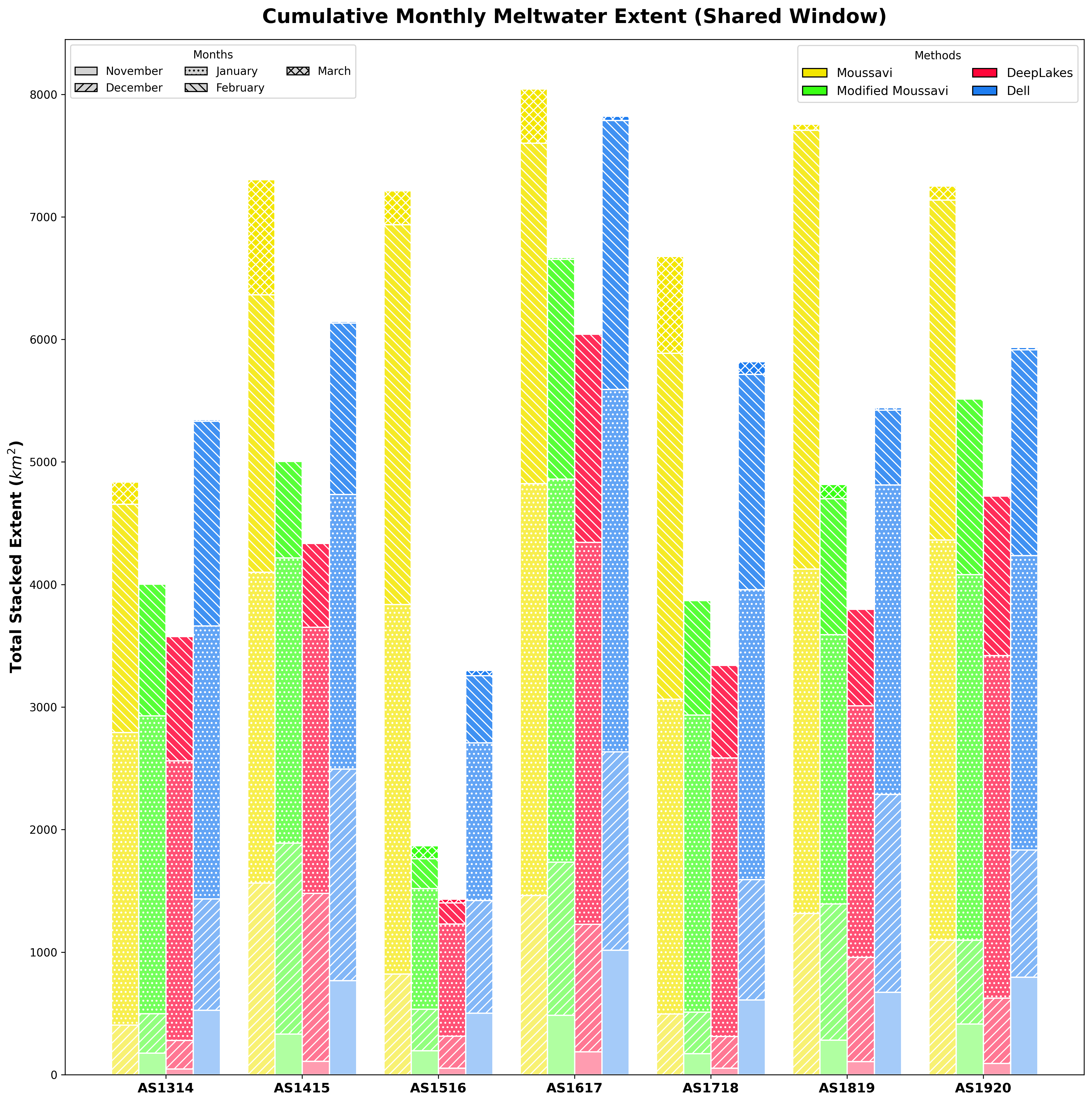
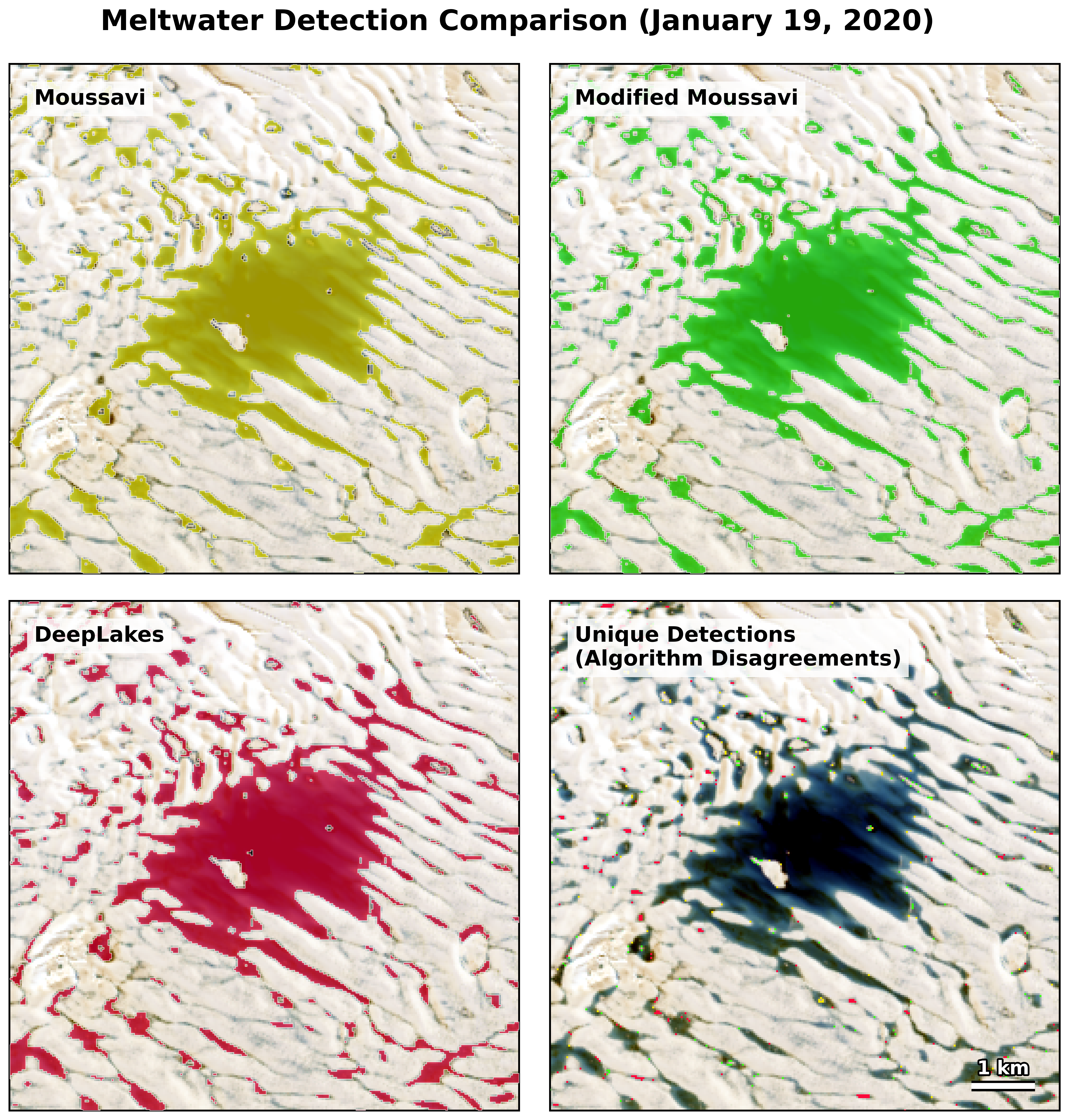
Abstract/Overview: This thesis evaluated and compared four autonomous algorithms (Dell, Moussavi, DeepLakes, and a Modified Moussavi approach) for detecting and classifying Antarctic supraglacial lakes using high-resolution satellite imagery. By processing extensive spatial data, the research quantified algorithmic accuracy in extreme environments, providing a framework for better monitoring of ice-shelf stability and hydrological routing.
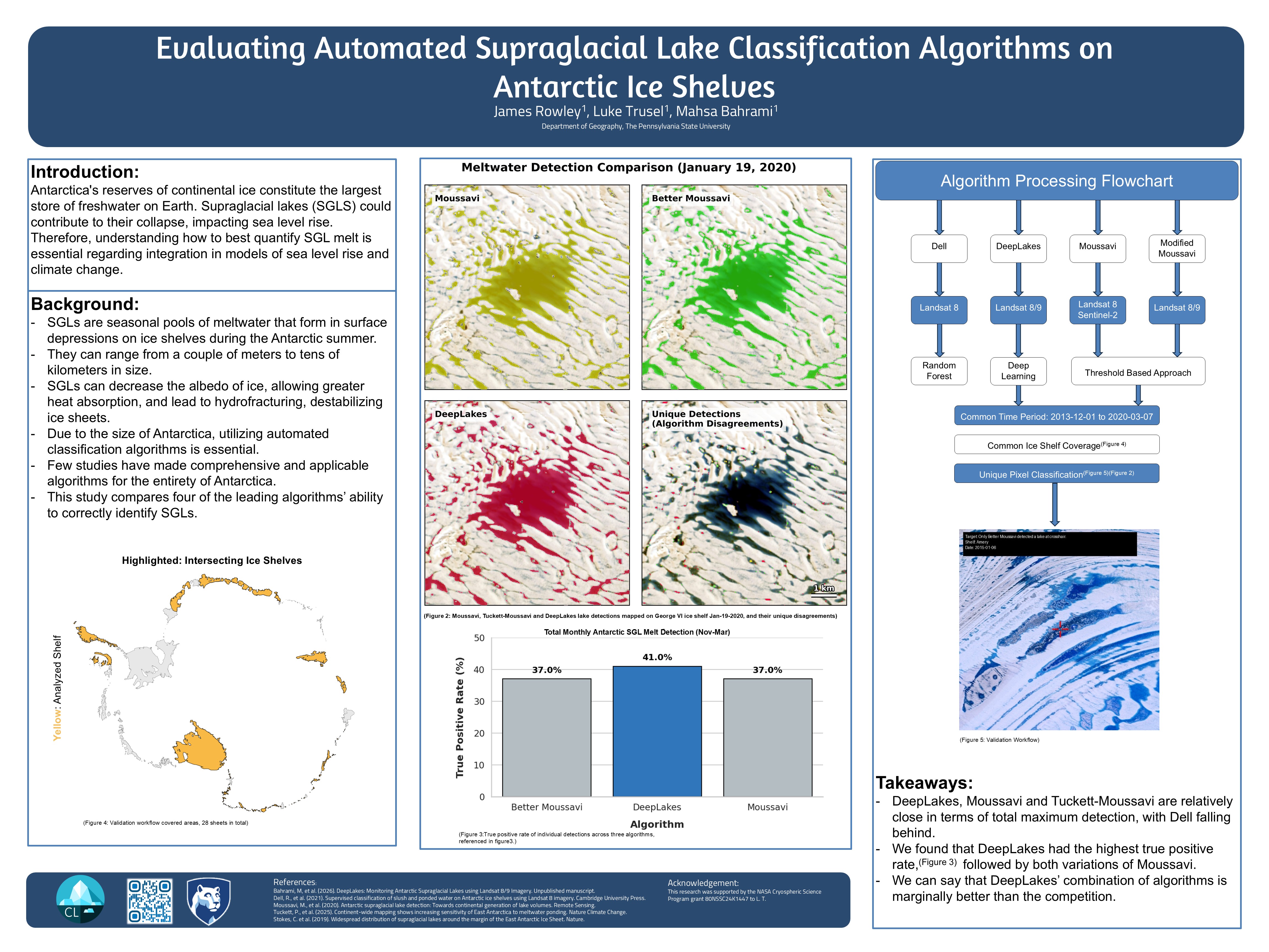
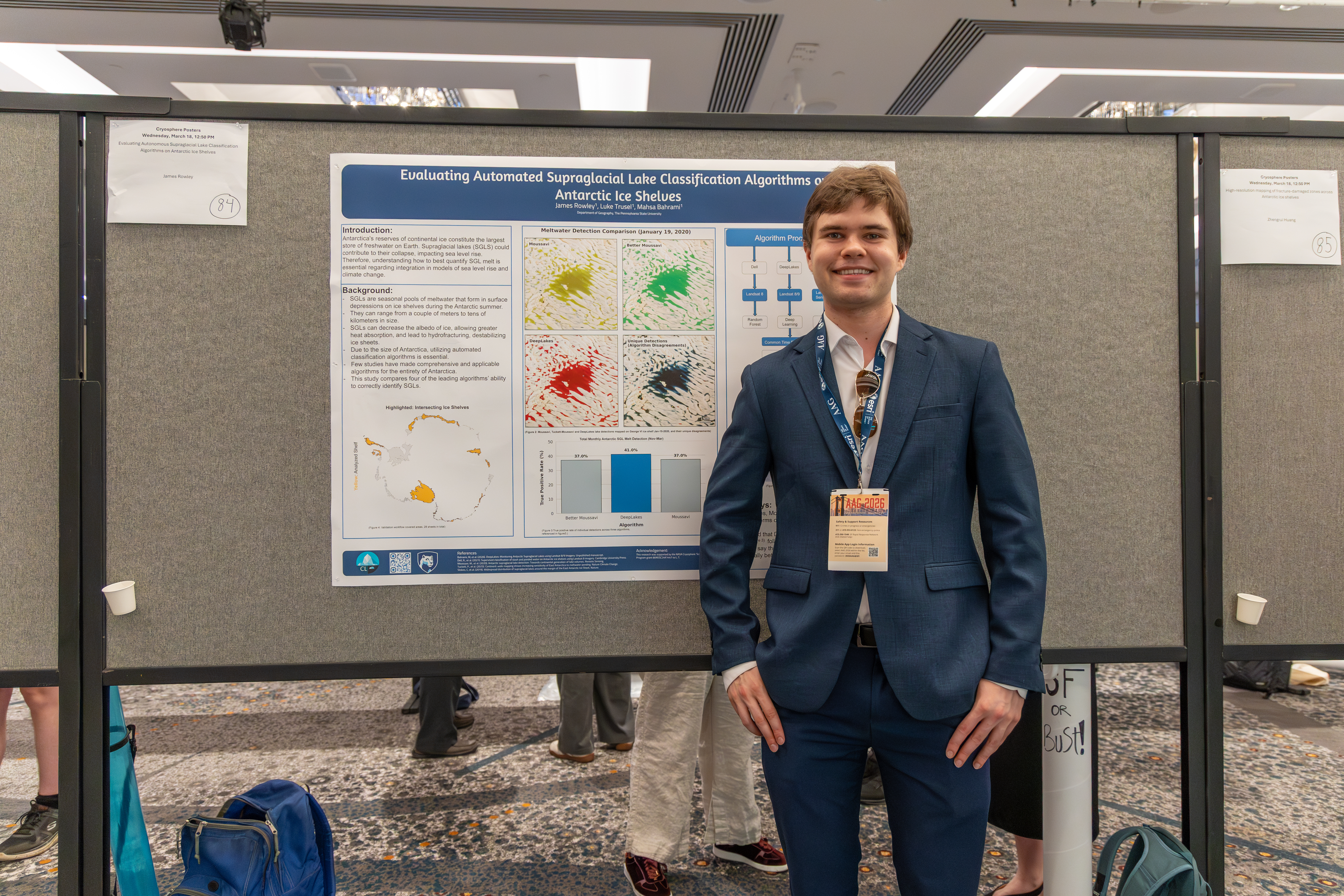
I formally presented the findings of this research, including the comparative poster above, at the American Association of Geographers (AAG) Annual Meeting.
Climate Data Pipeline (Python)
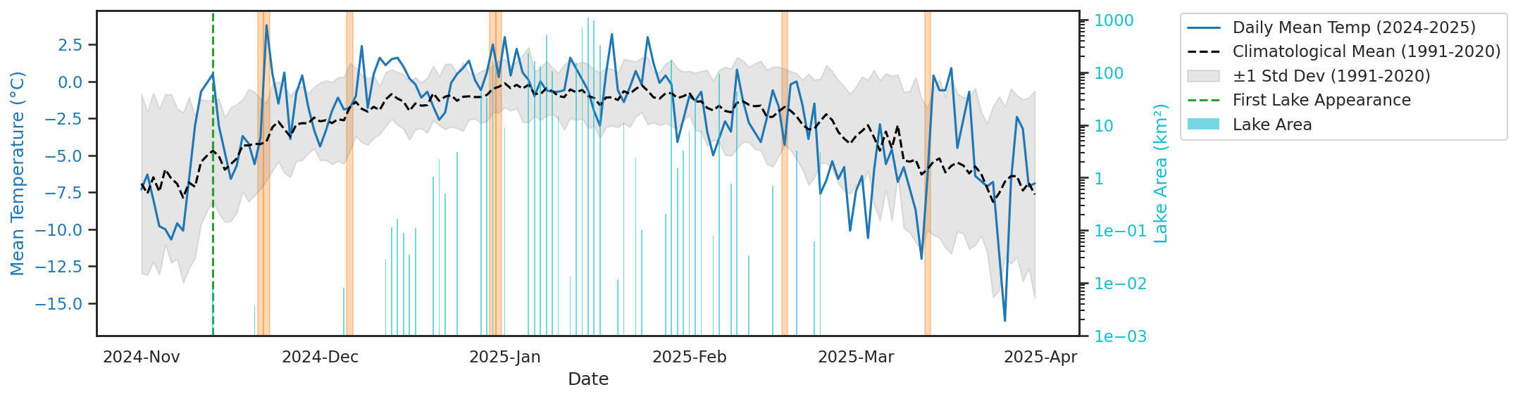
To support my thesis work on supraglacial melting, I engineered a Python-based pipeline to study the intersection of Atmospheric Rivers (ARs) with high-melt years in the Antarctic. I replicated Johnathan D Willie's AR detection algorithm, utilizing xarray and regionmask to process ERA5 Integrated Water Vapor Transport (IVT) reanalysis data.
The algorithm effectively isolates anomalous moisture transport events, allowing for statistical correlation between AR presence, local temperature spikes, and maximum lake area expansions on the ice shelf.
Deep Learning / Spatiotemporal Modeling
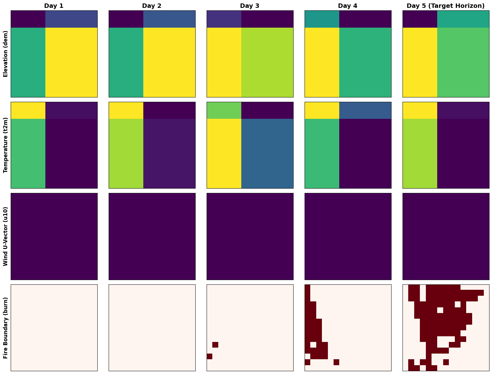
Developed a Convolutional Long Short-Term Memory (ConvLSTM) neural network designed to predict the spatiotemporal expansion of wildfires. By ingesting sequential fire burn satellite data, the model accounts for both the spatial relationships of the terrain and the temporal behavior of fire progression, yielding high-accuracy predictive boundaries.
Outside of work, I enjoy mountain biking, rock climbing, restoring vintage machines, and turn-based strategy games. Whether I am diving into a massive RPG campaign, optimizing data models to evaluate weekend sports performance, or spending an afternoon perfecting a rich curry or slow-cooked stew, I am always looking for dynamic systems to master and new challenges to tackle.